Geographic position
Dong Nai is a south – eastern province of The Socialist Republic of Viet Nam, with an area of 5,894.73 km2,
accounting for 1.76% of the nation natural area or 25.5% of the South -
eastern natural area. Population to the 2006 is 2,254,676 with a
density of 380,37 people/km2. According to the 2006 census, the natural increment of population is 1,22%. It has 11 dependent administrative units: Bien Hoa City, political, economic and social center of the province, Long Khanh town and the districts of Long Thanh, Nhon Trach, Trang Bom, Thong Nhat, Cam My, Vinh Cuu, Xuan Loc, Dinh Quan, Tan Phu.

Dong Nai is situated on the economic hub of southern Viet Nam and bordered by:
+ East by Binh Thuan Province;
+ North-east by Lam Dong Province;
+ North-west by Binh Duong and Binh Phuoc Provinces;
+ South by Ba Ria-Vung Tau Province;
+ West by Ho Chi Minh City.
Dong
Nai province has an advantage traffic system with many backbone
national roads crossing such as: National route 1A, national route 20,
National route 51, North – South railway lines; Locating adjacently to
the Saigon Port and Tan Son Nhat International Airport offers
many advantages to economic activities in the location. Its location is
very important for the development of the Southern economic main hub
and a junction of the South Eastern and Tay Nguyen Highland.
TOPOGRAPHY
Dong Nai Province
has topography of a plain and flat land with rare scattered, mountains
and a gradual declivity in the southward direction. We can distinguish
following topographical forms:
a) Topography of a plain with two main forms:
-
River platforms are 5 to 10 meter high, even only 2 to 5 meter high
along rivers and form narrow strips the width of which varies from about
20 meters to some kilometers. Soils on this topography are mainly
modern alluvia.
- Hollow topography on sea marshy sediments: They are hollow land area in Dong Nai Province,
the height of which varies from to 0.3 to 2 meters; several places are
lower than the area level, permanently flooded by tides; other places
are criss – crossed by rivers and covered by flooded salted forests.
Materials are not homogeneous and consist mainly of clay and settled
organic substances.
b) Undulating topography:
Its
height is 20 to 200 meters, consisting of basaltic hills. The relief
surface is very flat with slope from 30 to 80. This kind of relief
occupies a very large area compared with other topographies, consisting
mostly of basalt and ancient alluvia. Here, soils are red, yellow or
grey.
c) Relief of low mountains:
It
consists of scattered remaining mountains which are the southeast part
of the Truong Son chain with a height of 200 to 800 meters. This relief
is mainly distributed in the modern part of the province, on the border
between Tan Phu district and Lam Dong province, in Dinh Quan and Xuan
Loc districts with some remaining mountains. All these mountains are
some 20 – 200 meters high with open – cast base rocks consisting mainly
of granite and clayey rocky schist.
In general, land in Dong Nai has a relatively flat relief, 82,09% of which have a slope <80, 9.2% a slope < 150 and 8% a slope > 150.
- Alluvial soils, clayey soils and sandy soils have a flat topography; many hollow places are flooded all year round.
- Most of black, brown and grey soils have a slope < 80; most of red soils have a slope < 150.
- In particular, thin – layered soils and porous rocks have a high slope.
LAND SOURCE
Dong Nai Province
has a varied and fertile land funds. There are 10 main groups of soils.
However, based on land origin and quality soils may be divided into the
following 3 general groups.
-
Soils formed on a basalt base, such as porous soils, black soils and
very fertile red soils, accounting for 39.1% of the province natural
area (229.416ha) distributed in the northern and north – eastern part of
the province. These soils are appropriate for short and long – term
industrial trees: rubber trees, coffee, pepper…
-
Soils formed on a base of ancient alluvia and schist’s of clayey rocks:
grey soils, brown gray soils and party-coloured soils, accounting for
41.9% of natural area (246.380 ha), distributed in the southern, and
south – eastern parts of the province (Vinh Cuu, Thong Nhat, Long Thanh
and Nhon Trach districts, and Bien Hoa city). These soils are not very
fertile, appropriate for short – term tress: beans, a number of fruit
trees and perennial industrial trees, such as cashew…
-
Other soils formed on a base of new alluvia, such as alluvia soils,
sandy soil, distributed mainly along Dong Nai and La Nga rivers. They
are fertile appropriate for many trees, such as food trees, vegetables,
fruit trees…
-
As prescribed by the land law, land inventory is made once every 5
years on 18.08.1999 the Prime Minister issued directive no.24/1999/TC –
TTg about general land inventory in 2000. The Cadastre and Real – estate
Technical Centre was empowered to work in coordination with Cadastre
offices in districts, villages, wards and towns in the province to carry
out the 2000’s general land inventory. Data of general land inventory
were examined and accepted for uniform use in the whole province for the
period 2001 – 2005.
The province total area is 589,473 ha, of which:
- Area of agricultural land: 302,845 ha.
- Area of forested land: 179,807 ha.
- Area of land for special use: 68,018 ha.
- Area of land for dwelling houses: 10,546 ha.
- Area of unused land, rivers, springs, mountains: 28,255 ha.
Dong Nai has 10 main groups of land (soils):
- Gray soils: 40.05% of the province natural area, appropriate for agricultural production and construction.
- Black soils: 22.44% of the natural area, appropriate for annual trees.
- Red soils: 19.27% of the natural area, very appropriate for perennial industrial trees.
- Besides, Groups of alluvia soils (4.76%) appropriate for paddy, vegetables and other land:
- Forested land: 292,611 ha
- Agriculture land: 174,762 ha.
- Land for special use: 70,286 ha.
- Land for dwelling houses: 10,975 ha.
Over
the past years the use of land in the province underwent more or less
changes. But at present, Dong Nai is still the province which possesses
the largest area of agricultural land in the eastern region of South Viet Nam.
CLIMATE
Dong Nai lies in the monsoon tropical zone and is 
affected by the north-east and south-west monsoon. It is also put under the influence of Pacific Ocean
tropic atmosphere between April and October. Climate is cloven in two
distinct seasons. The rainy season lasts from March or April to November
and the dry season from December to March or April of the following
year. Average temperature goes between 23.9 – 290C, much lower than standard level of the tropical regions (26-300C). Its rainfall is quite high with 1,500mm – 2,700mm.
On
average, the weather is sunny for 4-9.5 hours a day and does not exceed
11.5 hours per day, even on the hottest and sunniest days. Total rainy
days within a year are between 120 - 170 days (standard level of
tropical region is 150 - 160 days) with total rainfall of some 1,500 -
2,750 mm. The average humidity is around 80 - 82% and humidity in the
dry season is 10 - 12% lower than that of the rainy season. The humidity
is inconsiderably differential among the areas.
Dong
Nai province's weather with regular sunshine, rain and high humidity
equally found in the localities facilitates agricultural production and
development of industry and cultural and tourism activities.
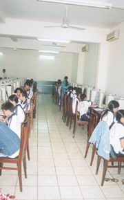
LABOUR SOURCES
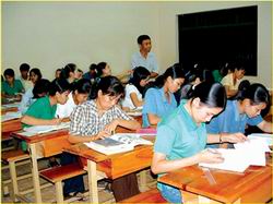
- Dong Nai has a population of 2.2 million inhabitants (1.1 million people in labour age). Number of high school students: 485.000.
- Dong Nai has 13 university, colleges, and secondary vocational school, attended by 19.000 students, pupils.
- Dong
Nai has 53 vocational centers teaching 51.200 persons in the following
occupations: electric technique, mechanics, construction, transport,
information technology, culture and arts, medicine, agriculture and
processing of agricultural products, safeguard and protection, machine
installation.
- If the local labour source closes not meet requirements investors may recruit labours from other provinces of the nation, even a number of foreign labours.
- In
2004, Dong Nai provided employment to 78.200 labours (including 37.110
inhabitants of Dong Nai province), sent 233 persons to foreign countries
for employment and vocational training reducing the urban unemployment
radio to 3.4% and increasing the rural employment radio to 83%. In the
year, province organized vocational training 51,200 participations;
increase labour rate after vocational training is 30%.
-
In the economic condition, first and foremost industry and service
increase rapidly, so it is attracted many labours from the other
localities and cities: In 1990 it is attracted further 12,000 labours
and in 2000 the number is estimated attracting further 65,000 labours.
According
to data in the Annual Statistics of 2004, Dong Nai had 672,331 urban
habitants (31.4%), taking the higher level than the average of Viet Nam which is only 23.5%. Urban habitants have been increased by 2.78% annual in the past 5 years.
|
Items |
2000 |
2005 |
2010 |
Increase from 2001-2005 |
Increase from 2006-2010 |
|
A. Aggregate population |
2,044 |
2,215 |
2,374 |
1.7% |
1.4% |
|
+ Urban |
641
31,5% |
797
36% |
956
40% |
4.5% |
3.7% |
|
+ Rural |
1.395
68,5% |
1418
64% |
1478
60% |
0,3%
[quick urbanization] |
0,8%
[slow urbanization] |
|
B. Population at working ages |
1,073 |
1,275 |
1,442 |
3.0% |
2.5% |
SOCIETY – CULTURE:
Some data about society and culture on 1st half of 2005:
- Number of sick exemption: 1,883,278 people time, 89.90% in comparison with last year.
- Number of babies was injected all kind of vaccine: 406 babies, 57.10% in comparison with last year.
- Number of high school pupil in midyear: 473,500 pupils, 98.10% in comparison with last year.
- Number of high school teacher in midyear: 17,030 teachers, 101.10% in comparison with last year.
- Number of new job created: 44,035 people, 100.70% in comparison with last year.
- Number of persons attended vocational training: 27,147 people, 77.20% in comparison with last year.
RESOURCES
Dong Nai is plentiful with forest resources, granite mine, construction stone, clay, kaolin, puzzolan, sand, gravel…etc.
Besides, Dong Nai Province is based essentially on the system of lakes, dams and rivers, of which Tri An Lake with 323 km2
and over 60 rivers, rivulets and canals are very favourable for the
development of a number of aquatic products: raft – bred fish, bred
shrimps.
Aquatic resources
Surface water:
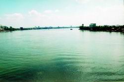
Dong Nai Province has a river density of about 0.5 km/km2, but unevenly distributed. Most of rivers and springs are concentrated in the northern region and along the Dong Nai River in the south – western region. The total quantity of water is fairly high: 16.82 x 10⁹ m3/year, which accounts for 80% in the rainy season and 20% in the dry one.
a) Dong Nai River: It flows into Dong Nai Province on a level 3 relief, where is the middle part of the river.
The
part from the Dong Nai – Lam Dong border to the mouth of Song Be River
(in Tan Uyen) flows in the south – eastern direction. The basin of the
middle part, which is 100 – 300 km, from Ta Lai to Tri An, has many
falls. Past Tri An, the river flows quietly, becomes wider and deeper.
The longest tributaries of Dong Nai River are La Nga and Song Be rivers.
b) La Nga River: The part of La Nga River in Dong Nai Province
is 55 km long, has many bends and falls (Troi Cao falls 5 meter –
high). This part of La Nga River is narrow, receives many tributaries,
such as Gia Huynh and Tam Bung springs. Gia Huynh springs has a basin of
135 km2, its flow module is 91/s.km2 in the dry season and 47.41/s.km2
in the rainy season, having its source in National Route 1 area (at the
Dong Nai – Binh Thuan border). Tam Bung spring has a basin of 155 km2, has its source in the northern region of Xuan Loc plateau, having a flow module of 101/s.km2 in the dry season and 651 651/s.km2 in the rainy season.
La Nga River discharges into Tri An Lake a quantity of about 4.5 x 10⁹ m3/year, accounting for 1/3 of the Lake water; its average annual flow module is 351/s.km2.
c) La Buong River:
It has its source in the western part of Xuan Loc plateau and flows in
the western direction, its basin slope being 0.0035. The river longest
part is about 40m – long. The river has a high quantity of water
compared with other smaller rivers in the region, with about 0.23x 10⁹ m3/year; its flow module is 27.61/s.km2.
d) Song Ray River:
The
river basin occupies nearly 1/3 of the southern part of Dong Nai
province. It has its in the south – eastern part of Xuan Loc plateau and
flows directly into the sea in the southern direction. Its basin slope
is fairly high (0.004). So, if there are not dams to hold water, the
river water will flow into the sea rapidly, and it is often dry in the
dry season. The total quantity of water of the river is fairly high:
0.634x 10⁹ m3/year, 79% of which is provided by the rainy
season. Song Ray, if utilized rationally, can solve the drought problem
for the south – eastern part of the province.
e) Song Xoai and Thi Vai rivers:
These
two rivers are located in the south – western part of the province,
having their sources on Xuan Loc plateau and flow directly into the sea.
Thi Vai River,
in its upstream part, has many small and step springs; its downstream
part is wider and contains salted water (from south of National Route 51
to Vung Tau).
- Song Xoai has 2 main branches: Chau Pha and Suoi Dun and other short and narrows springs. The basin area is 184 km2, the average quantity of water is 0.1015x 10⁹ m3/year, and the flow module is 17.51s.km2/year.
Song Xoai plays an important role in agricultural production of Chau
Thanh district and fresh water supply to Vung Tau. The Song Xoai
downstream part contains salted water, which is as salted as sea water.
Underground water:
The Reserve of static water of the whole Dong Nai Province is 793,379 m3/day, of which the capacity reserve is 789,689 m3/day and the elastic reserve is 3,691 m3/day.
The reserve of dynamic water is about 4,714,847 m3/day which is the whole surface current in the dry season and the lower limit of the underground water reserve.
- So, the total underground water reserve of Dong Nai Province is about 5,505,226 m3/day.
Although
the above reserve is rich, its distribution is uneven; there is no
water in the dry season, when water needs are very high. So, the
exploitation of underground water must follow a rational exploitation
planning.
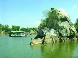
TOURISM RESOURCE:
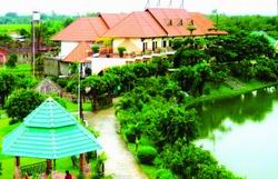
Dong Nai is a place located a lot of historic and cultural spots and many other potential torist locations such as: Tran Bien Temples, Nguyen Huu Canh Temple, Buu Long Tourism Places, Dong Nai Riverside, Nam Cat Tien National Garden, Tan Trieu Polemo Village, Mai Waterfall - warm water lake, O-Dong Nai Island...
Coming
to Dong Nai, tourists will have chance to take ecotourism tour to
forests, orchards; fishing on Dong Nai River; going panic on Long An
lake; Suoi Tre Cultural Places, Tri An Waterfall, Ma Da jungles... or
visiting historic and cultural places such as Chien Khu D base, Van Mieu
Temple, Hang Gon sepulchre, Binh Da Lithophone.
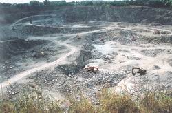
MINERAL RESOUCES:
Metals:
1.
Good: To date 17 mines of good ores and mineralized gold have been
discovered, mainly in the northern part of the province. Two mines in
Hieu Liem and Vinh An are rich in potentialities. Other points, where
the reserve of gold ores has not been assessed fully, are located at
Suoi Ty, Suoi Nho, Tam Bung, Sa Mach spring, Vinh An, La Nga and Hieu
Liem forestry State farms.
2.
Aluminum (Bauxite): Two mines of bauxite have been recently discovered
at Datapok (Ma Da Forestry State Farm) and La Nga State Forestry Farm,
with an area of 1,120 ha, but 2/3 of it are located in a prohibited zone
(Nam Cat Tien forest). Its reserve is estimated to be about 450 million
m3.
3.
Tin: It is present in scattered edges of mineral layers. These edges
are large, but poor in tin, insignificant for survey, concentrated on
Chua Chan Mount. At Suoi Ret, Suoi Sao and in Gia Ray River.
4. Lead and zinc in rich ores: discovered on Chua Chan Mount.
Non – metal minerals:
1.
Kaolin:10 mines have been discovered, mainly small mines and points of
ores, concentrated mainly at Phuoc Thien, Hang Nai, Phuoc Tho, Tam Hoa,
Tan Phong, Binh Y, Thanh Phu.
2. Coloured clay: At present, nines points of ores have been discovered at Long Binh Tan, Xuan Khanh and Xuan Loc.
3. Line stones: Only 2 points have been discovered at Tan Phu and Suoi Cat.
4. Quartz layers: scattered in many places, only 01 point has been discovered at Xuan Tam (Xuan Loc district).
5.
Stones for construction and tiling: Stones for construction: 24
quarries in exploitation, concentrated in Bien Hoa, Thong Nhat, Trang
Bom, Long Thanh, Vinh Cuu, Dinh Quan, Nhon Trach, Xuan Loc.
6. Sand for construction: mainly in the Dong Nai River, from Tan Uyen bifurcation to Mui Den Do bifurcation, the reserve of which has been surveyed and assessed.
In addition, there is sand in small rivers and springs in Dinh Quan, Tan Phu, especially in Tri An Lake bed.
7. Sand for land filling: At Phuoc An (Dong Mau Rua, Go Sim…) Nha Be River, Dong Tranh.
8.
Clay for making bricks and tiles: fairly abundant, distributed mainly
at Thien Tan, Thanh Phu (Vinh Cuu district), Long An, Long Phuoc (Long
Thanh district).
9. Keramzite: Distributed at Dai An and Tri An with a reserve of about 8 million tons.
10.
Puzolan: Very abundant, concentrated in Dinh Quan, Dong Thanh and some
of it at Cay Gao, Gia Kiem (Thong Nhat district) and Vinh Tan (Vinh Cuu
district ).
11. Laterite: Fairly abundant, concentrated in Vinh Cuu, Bien Hoa, Long Thanh and Nhon Trach.
Precious and semi – precious stones:
- In small quantity, no expectation for industrial exploitation:
1. Zircon: Gia Kiem, Nui La, Tan Phong.
2. Sapphire: La Nga Bridge, southern part of Tan Phong, Gia Kiem.
3. Pyrop – zircon:
4. Opal – chalcedony: Chua Chan Mountain.
5. Tecfic: Northern part of Ta Lai.
- Mineral water, hot water and underground water:
1. Mineral water and hot water: Phu Loc and Kay.
2. Mineral water with Maggie – bicarbonate: Suoi Nho.
3. Super – tasteless mineral water: Tan Phuoc and Nhon Trach.
4. Ferrous mineral water: Southern part of Thanh Tuy Ha.
5. Salted water with Natrium chloride: southern part of Thanh Tuy Ha.
6. Underground water: Bien Hoa, Long Thanh, Nhon Trach, villages of Dong Nai and La Nga rivers.
FOREST RESOURCES:
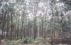
- Forests in Dong Nai Province have basic characteristics of tropical forests with many varied species of animals and trees, as represented by Nam Cat Tien National Park. In 1976 forests covered 47.8% of the natural area of the province; in 1981, this ratio was reduced to 21.05%.
In 2004, forests covered 26.05% total of natural area, including Nam Cat Tien National Park,
a natural reserve region rich in rare and precious animal and vegetal
species with the implementation of the present program for forest
cultivation (including the cultivation of perennial industrial trees),
it is foreseen that the conversing ratio will be 45 – 50% by 2010.
Area of kinds of forests:
|
Kinds of forests |
Total areas |
Natural |
Cultivated forests. |
|
Forests for special use |
82,795.50 |
80,520.40 |
2,275.10 |
|
Protective forests |
44,144.20 |
21,366.80 |
22,777.40 |
|
Forests for exploitation |
26,646.30 |
8,406.40 |
18,239.90 |
|
Total |
153,586 |
11,293.60 |
43,292.40 |
TRANSPORTATION
Dong Nai has big progress of investment in upgrading transport
system, especially in roads. National highway system with total 244.5
km long has been improving and widening up to delta highway level 1 and 2
standard (National Highway No 5 and 6) or up to third grade like
National Highway No 20 to Da Lat, on that way there was 75 kilometers in
the province territory had been spread on the surface). Roads system in
the province lengthens 3.339 kilometers, of which nearly 700 kilometers
is tar surface roads. Moreover, roads system under commune and ward
management, roads in farms, industrial parks make a continuous system to
localities, 100 percent communes and wards have roads for cars to its
center.
Under scheme in the near future, high speed ways system to Ba Ria Vung Tau and Ho Chi Minh City,
Bien Hoa-Vung Tau railway system, upgraded provincial roads No 726 and
connecting national highway No 20 and No 1 with national highway No
51... Will create a complete system, serving for socio economic
development demand locally and regionally. Dong Nai Port system include:
+ Long Binh Tan Port:
On Dong Nai river far from national highway No on the right from HCMC
to Ha Noi 800 kilometers; Capacity 460000 tons per years with 2000 GRT
ship, a 60 meters long wharf has been finished and put into operation; a
barge port for 5000 DWT after dredging in the future. Major office will
be located in Long Binh Tan ward, Bien Hoa city. Telephone number:
84.61.383225/3831439 - Fax: 84.61.3831259.
+ Go Dau A Port:
On the Thi Vai river, 2 kilometers far from national highway No 51 on
the right from Bien Hoa to Vung Tau. At present, the biggest ship size
can access is 2.000 GRT; but in the future hope for 10.000 DWT one.
Office located in Phuoc Thai commune, Long Thanh district, Dong Nai
province, telephone number: 84.61.3827328 - Fax: 84.61.3841252.
+ Go Dau B Port: On the Thi Vai river, far from 2.5 kilometers
on the right of the road No 51 from Bien Hoa to Vung Tau. It is put
operation and will be upgraded to the deigned capacity of 10 m tons per
year, 2 sides are capable of receiving 15.000 DWT ship. The Office is
located at Phuoc Thai commune, Long Thanh district, Dong Nai province.
Telephone: 84.61.3841599 - Fax: 84.61.3816790.
There
are main services: marine agent, loading and unloading, container,
shipping and receiving transport. The quantity of goods is through the
ports about 700,000 tons/year. It is estimated increasing quantity of
goods through the ports over 25 – 30 million tons/year.
National railway station system in the province
Railway
station system in the province spreads 87.5 kilometers long with 12
stations: Gia Huynh, Trang Tao, Gia Ray, Bao Chanh, Xuan Loc, An Loc,
Dau Giay, Bau Ca, Trang Bom, Long Lac, Ho Nai vµ Bien Hoa. This line is
the important transport blood vessel linking Dong Nai with The North and
HCMC.
(Source Dong Nai Statistical Office)